Satellite crop monitoring has an obvious appeal and a less obvious limit. The appeal is that you can see every field you farm without driving to any of them. The limit is that a satellite measures reflected light, and reflected light tells you something is wrong without telling you what.
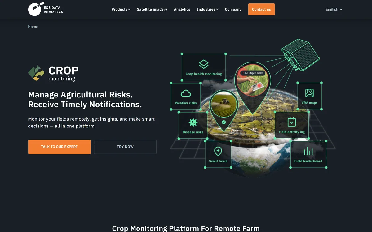
EOSDA Crop Monitoring, from EOS Data Analytics, is one of the more complete attempts to close that gap. It layers vegetation indices, growth-stage tracking, weather, risk maps and yield estimation over Sentinel-2 and PlanetScope imagery, and pushes the output into things you can act on — including variable-rate application maps and a John Deere integration.
This review is about where that chain holds and where it breaks: which indices answer which question, why cloud correction is not a footnote, and what the platform genuinely cannot see.
| Company | EOS Data Analytics, Inc. |
|---|
| Product type | Satellite-based precision agriculture and crop monitoring |
|---|
| Imagery sources | Sentinel-2 and PlanetScope |
|---|
| Best resolution | Up to 3 metres, with daily monitoring on the commercial source |
|---|
| Vegetation indices | 10, including NDVI, NDMI, RECI and MSAVI |
|---|
| Image correction | Cloud and shadow removal |
|---|
| Named features | Growth Stages, Risk Map, VRA Maps, Field Activity Log, Yield Estimation, Weather Analytics, Automated Reports, Team Management |
|---|
| Machinery integration | John Deere |
|---|
| Intended users | Growers, agricultural consultants, insurers, regional monitoring bodies |
|---|
| Related products | LandViewer, EOS RayVision, EOSDA API Connect |
|---|
| Delivery | Cloud platform |
|---|
- Scouting triage, not scouting replacement. The imagery tells you which field is behaving oddly; your boots still tell you why.
- Two imagery sources: free Sentinel-2 on its regular cycle, and commercial PlanetScope at up to three-metre resolution with daily revisit.
- Ten vegetation indices including NDVI, NDMI, RECI and MSAVI — different indices answer different questions, and using one for everything is the common mistake.
- Beyond imagery: growth stages, risk maps, weather analytics, yield estimation, a field activity log and variable-rate application maps.
- Cloud and shadow removal matters more than it sounds — an uncorrected cloudy pass reads as a crop problem that is not there.
Two Satellites, Two Different Bargains
The imagery underneath determines what the rest of the platform can do, and the two sources are not interchangeable.
Sentinel-2 is the European Space Agency's open programme. It is free, well-calibrated, and revisits on a fixed multi-day cycle at around ten-metre resolution for the key bands. For season-long trend watching across many fields it is entirely sufficient.
PlanetScope is commercial, reaches up to three-metre resolution, and revisits daily. That combination matters in exactly two situations: when a problem is developing faster than the Sentinel cycle can catch, and when the feature you need to see — a drainage line, a headland, a small patch — is smaller than a Sentinel pixel usefully resolves.
The honest guidance is that most growers are well served by the free source most of the time, and should reach for daily high-resolution imagery when something is actually happening rather than as a standing subscription habit.
Choosing The Right Index For The Question
Ten vegetation indices sounds like feature padding. It is not, because indices are not better and worse versions of each other — they are sensitive to different things, and the wrong one answers a question you did not ask.
NDVI measures the contrast between near-infrared and red reflectance, which tracks green biomass well. It is the default for a reason: through most of the growing season it is a reliable proxy for how much healthy canopy is there.
Its well-known failure is saturation. Once a canopy closes, NDVI stops distinguishing a good crop from an excellent one, and a mid-season field that looks uniformly strong may not be.
Where NDMI And MSAVI Earn Their Place
NDMI responds to moisture content rather than greenness, which makes it the index to look at when the question is water stress rather than vigour — often before the stress is visible in NDVI at all.
MSAVI is built for early season. With little canopy and a lot of visible soil, standard indices are contaminated by the soil's own reflectance; MSAVI corrects for it, which is why emergence assessment uses it rather than NDVI.
RECI And The Nitrogen Question
RECI uses the red-edge band and tracks chlorophyll content more directly, which makes it the more informative index for nitrogen status.
This is the index that connects monitoring to a decision with money attached, because chlorophyll variation across a field is the input a variable-rate nitrogen prescription is built from.
From Looking At Fields To Changing What You Do
A monitoring platform that only produces pictures generates work rather than saving it. The features that turn observation into action are the ones worth judging EOSDA on.
VRA maps convert in-field variation into a prescription a controller can execute, so a nitrogen or seed rate follows the field rather than an average of it. The John Deere integration matters here for an unglamorous reason: a prescription that cannot reach the machine is a PDF.
Growth stages tie observations to crop phenology, which is what makes an index reading interpretable — the same NDVI value means different things at emergence and at flowering. Risk maps flag areas warranting attention, weather analytics supply the context that explains most anomalies, and the field activity log records what was actually done, which is the only way next season's analysis means anything.
Yield estimation and automated reports serve the office rather than the field — useful for insurers, lenders and anyone managing land they do not personally walk. Team management exists because most of the real customers are consultants and organisations, not single growers.
The satellite tells you which field to walk. It does not tell you what you will find when you get there — and a platform that implied otherwise would be selling something it cannot deliver.
Working It Into A Season
The platform rewards a routine rather than occasional curiosity.
- Draw your field boundaries accurately once — every downstream figure inherits the errors in this step.
- Use MSAVI early for emergence and establishment, while bare soil still dominates the signal.
- Switch to NDVI for in-season vigour tracking, and treat sudden divergence between neighbouring zones as the signal worth investigating.
- Check NDMI when weather suggests water stress, rather than waiting for it to show up as lost vigour.
- Use RECI where nitrogen decisions are in play, and build variable-rate prescriptions from that rather than from raw greenness.
- Log every operation in the activity log as it happens, so next season's comparison has something honest to compare against.
- Walk the anomalies. Every time. The imagery is a prioritised list of places to stand, not a diagnosis.
The Limits Worth Knowing Before You Buy
Cloud is the fundamental constraint, and no amount of software removes it. EOSDA applies cloud and shadow removal, which is genuinely important — an uncorrected cloudy pass produces a dark patch that reads exactly like a crop problem — but correction fills gaps in the record rather than seeing through weather. In a persistently cloudy region, optical monitoring has bad weeks.
The second limit is diagnostic. Indices measure reflectance, and disease, pest damage, nutrient deficiency and compaction can all produce similar signatures. The platform reliably tells you where something is different; deciding what it is remains an agronomic judgement made on the ground.
Third, yield estimation is a model, and models carry uncertainty that a single headline number tends to hide. Treat estimates as ranges, particularly in an unusual season.
And finally the boundaries: EOSDA is one product in a wider EOS Data Analytics portfolio that includes LandViewer, EOS RayVision and EOSDA API Connect. If your need is raw imagery access or a different vertical entirely, the crop monitoring product may not be the right door.
Index Names, Decoded
Half the value of the platform is choosing the right layer. These are the four that do most of the work.
- NDVI
- Normalized Difference Vegetation Index. Tracks green biomass and is the general-purpose default. Saturates once the canopy closes, so it stops distinguishing good from excellent mid-season.
- NDMI
- Normalized Difference Moisture Index. Responds to moisture content, so it flags water stress — often before that stress is visible as lost vigour.
- MSAVI
- Modified Soil-Adjusted Vegetation Index. Corrects for bare-soil reflectance, which makes it the right choice early in the season when the canopy is sparse.
- RECI
- Red-Edge Chlorophyll Index. Tracks chlorophyll more directly than NDVI, which is why nitrogen decisions and variable-rate prescriptions are usually built from it.
- VRA
- Variable Rate Application. A prescription that varies inputs across a field instead of applying one rate everywhere — the point at which monitoring turns into a saving.
- Revisit interval
- How often a satellite passes over the same point. Sentinel-2 runs a fixed multi-day cycle; PlanetScope offers daily coverage, which matters when a problem moves faster than the cycle.